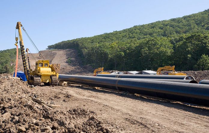
Linear schemes which can include road and rail, waterways, pipelines and cabling, present a number of problems which other types of development do not encounter and have the potential to disturb a large number of sub-surface heritage assets
Transport, infrastructure and utility companies are therefore at particular risk.
In other words, the longer the scheme and the wider the corridor, the greater the risk from heritage assets. The length and location of a scheme will dictate the potential for heritage assets being present within the corridor or within its immediate vicinity.
The longer the scheme the greater the risk for the presence of:
- Scheduled Monuments
- Listed Buildings
- Above ground remains of a range of types and periods
- Below ground remains of a range of types and periods.
Below ground remains – establishing risk levels
Most worryingly for scheme contractors, on long linear schemes is the increased risk for the presence of unknown below ground archaeological remains – some of which could be judged of considerable importance or even of national significance.
There are of course ways of predicting and managing such risks to linear schemes and archaeological evaluation at an early stage is vital in assessing the likelihood of heritage assets being present and the degree to which they may have a major impact on the scheme in terms of both time and money.
Once the level of potential risk has been established, it can be minimised through re-assessing a selected route and offering the opportunity to look at other less sensitive route options. This in turn can help with estimating time and cost implications, allowing longer-term budgets to be put in place to deal with archaeological remains.
Evaluation on linear schemes
As stated previously, evaluating above ground heritage assets is easier than predicting the presence of unknown heritage assets, or predicting the level of known buried heritage assets by virtue of the fact they are invisible. It is also the case with buried archaeological remains that they are indiscriminate and can turn up in what might seem the most unlikely locations.
Archaeological evaluation of buried remains is rather like the art of divination except that, rather than using a crystal ball, archaeologists use a number of more accurate techniques which can include one or a combination of:
- Heritage impact assessment and cartographic analysis at local record offices to identify the presence of recorded heritage assets such as Schedule Monuments and to predict the likelihood of buried archaeological remains being present within a route corridor
- Geophysical survey can identify the presence of archaeological remains without the necessity of digging
- Trial trenching can be used to verify the presence or absence of buried archaeological remains and corroborate the results of geophysical survey.
Avoiding problems with linear schemes
Whilst these evaluation techniques are applied to developments in general, their application on linear schemes of any length can generate a particular set of problems in the field, which contained developments do not.
- The scheme may pass through a number of differing terrains from remote uplands to urban conurbations both equally difficult to reach on occasions though for different reasons
- Archaeological evaluation is complicated by the necessity of dealing with numerous tenants and landowners
- Crop regimes of different farmers may need to be considered and site evaluation planned to accommodate them
- Similarly grazing patterns of livestock have to be considered
- The logistics of getting a team, equipment and mechanical excavator to different parts of a scheme can be demanding.
Even at the heritage impact assessment stage, linear schemes – dependent upon their length – can impose a unique set of requirements:
- Linear schemes may pass through a number of different counties which requires consultation with several LPA Planning Archaeologists, all of whom may have different views on how they wish archaeological issues dealt within the sections of the scheme that pass through their area
- In turn there is a need to visit record offices in a number of different counties and to gather substantial levels of information for collation into a heritage impact report which assesses risks along the entire length of the route corridor as well as the locations of substations, compounds etc.
Again the longer the scheme the greater the level of information required to reliably assess the potential risks from heritage assets of all kinds and to provide reliable route alternatives if necessary.
Summary
Linear schemes tend to require a much higher level of project management and co-ordination than other types of development if they are to be successful.
Although utility companies have certain permitted development rights which do not obligate them to deal with archaeological remains, they also observe best practice in their approach. They are therefore, along with companies involved in road and rail construction, at risk when long linear schemes are involved.
As a result for all companies involved in the construction of linear schemes, early intervention and assessment of risks allows time for flexibility in selecting route options and allowing time to plan for and budget for archaeological investigation.
Ultimately, this can save both time and money for the main contractor as well as help preserve or record the archaeology which has to be the desired outcome for everyone.


